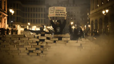
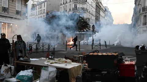
France rocked by nationwide clashes, blazes and looting
Macron condemns those who 'sought to bring down the Republic' after rioting mars nationwide protests
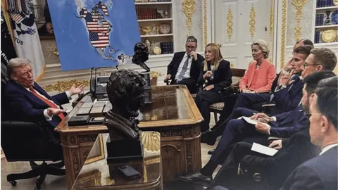
Trump posts altered photo suggesting expanded US territory
AI In-Brief
Thailand News in Brief
Thai PBS World
Thailand and the world, every day
AI can make mistakes. Please double-check.
Trump posts altered photo suggesting expanded US territory
10 Sept 16:57Key points summarised by AI
Former President Trump shared an altered image depicting a map of the United States expanded to include large parts of North and South America, as well as Greenland and Venezuela, displayed from the Oval Office.
He also posted a manipulated image showing himself planting the American flag on Greenland, declaring it "U.S. TERRITORY EST. 2026" and asserting its strategic importance with "no going back."
These posts drew sharp criticism, with Greenland's Prime Minister calling the imagery "disrespectful" and Venezuela's government urging citizens to defend their territorial integrity online.
Analysts note the visuals, particularly with AI elements, blur the line between symbolic political messaging and actual foreign policy, complicating diplomatic relations and potentially undermining international order.
Macron condemns those who 'sought to bring down the Republic' after rioting mars nationwide protests
Yesterday 12:56Key points summarised by AI
President Macron condemned widespread rioting and looting during nationwide protests, blaming far-left activists and criminals for the "unrestrained violence" and vowing accountability for those who "sought to bring down the Republic."
Over 2,400 arrests were made as protests against rising living costs and poor school conditions escalated, causing extensive damage to public buildings and businesses in cities like Paris, Limoges (where City Hall burned), Marseille, and Lyon.
The unrest, which organizers hoped would revive the "yellow vest" movement, saw political leaders trade blame, with Macron instructing prefects to protect public buildings and potentially ban future protests to prevent further disorder.