No need to panic! Thai PBS Verify confirms six volcanic eruptions in a single month are completely normal for Earth.
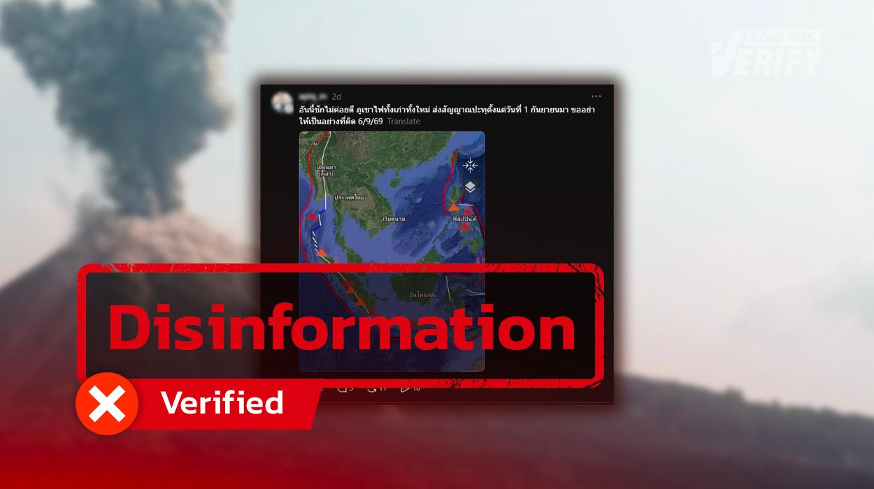
Thai PBS Verify found the source of the misleading news to be: Threads.
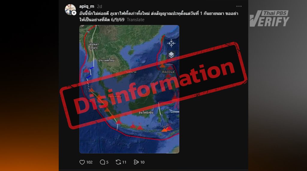
Posts allege that volcanoes are sending out warning signals
Thai PBS Verify found a user with the account name apiq_m in Threads who posted a message along with an image of a volcano map stating that…
This is getting bad. Both old and new volcanoes have been showing signs of erupting since September 1st. Let’s hope it’s not what we think. 6/9/69
The post, published on September 9, 2026, has been viewed over 3,900 times.
Is the volcanic eruption sending a danger signal?
Professor Dr. Santi Phailoplee, a lecturer in the Department of Geology, Faculty of Science, Chulalongkorn University, commented on the post, stating that the information about six volcanoes, both old and new, in Indonesia showing signs of erupting since September is true. However, he added that volcanic eruptions are normal , as the world naturally has thousands of volcanoes, with 452 located specifically in the Ring of Fire.

Prof. Dr. Santi Pailoplee, Department of Geology, Faculty of Science, Chulalongkorn University
“ Having two to three volcanoes erupting in the same month is totally normal and not strange at all. He likened it to people in the same condo building all taking a morning shower at the same time. Past records show that up to 56 volcanoes around the world have actually erupted simultaneously in a single month, such as in August 2021 and November 2021.”
In fact, having only six eruptions right now is considered quite low—or as one might say, ‘underperforming.’ Volcanic eruptions naturally occur every month because the Earth needs to release heat.
What does the Ring of Fire look like?
Professor Dr. Santi also stated that the image used in the post was untrue and exaggerated, trying to portray the situation as overly frightening. He explained that investigations in areas such as the Nicobar Islands revealed no signs of any eruptions.
If the poster intended the image to depict a “volcano erupting,” that’s not accurate. Even if it meant a “powerful volcano” or “ready to erupt,” the information provided is insufficient, as there are far more volcanoes capable of erupting than shown in the image.
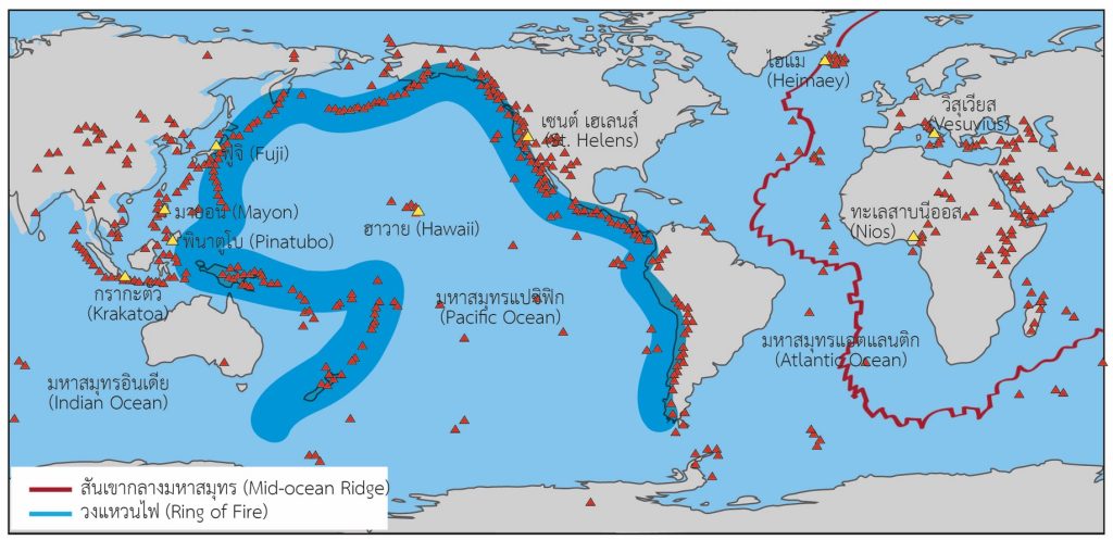
The world map shows the distribution of currently active volcanoes (red triangles).
What does the actual map of the Ring of Fire look like?
According to the United States Geological Survey (USGS), the Ring of Fire is a horseshoe-shaped boundary of tectonic plates, approximately 40,000 kilometers long, surrounding the Pacific Ocean. It is the site of 90% of the world’s earthquakes and is home to more than 75% of the world’s volcanoes, stretching from South America and North America, through Alaska, Japan, the Philippines, Indonesia, and to New Zealand.
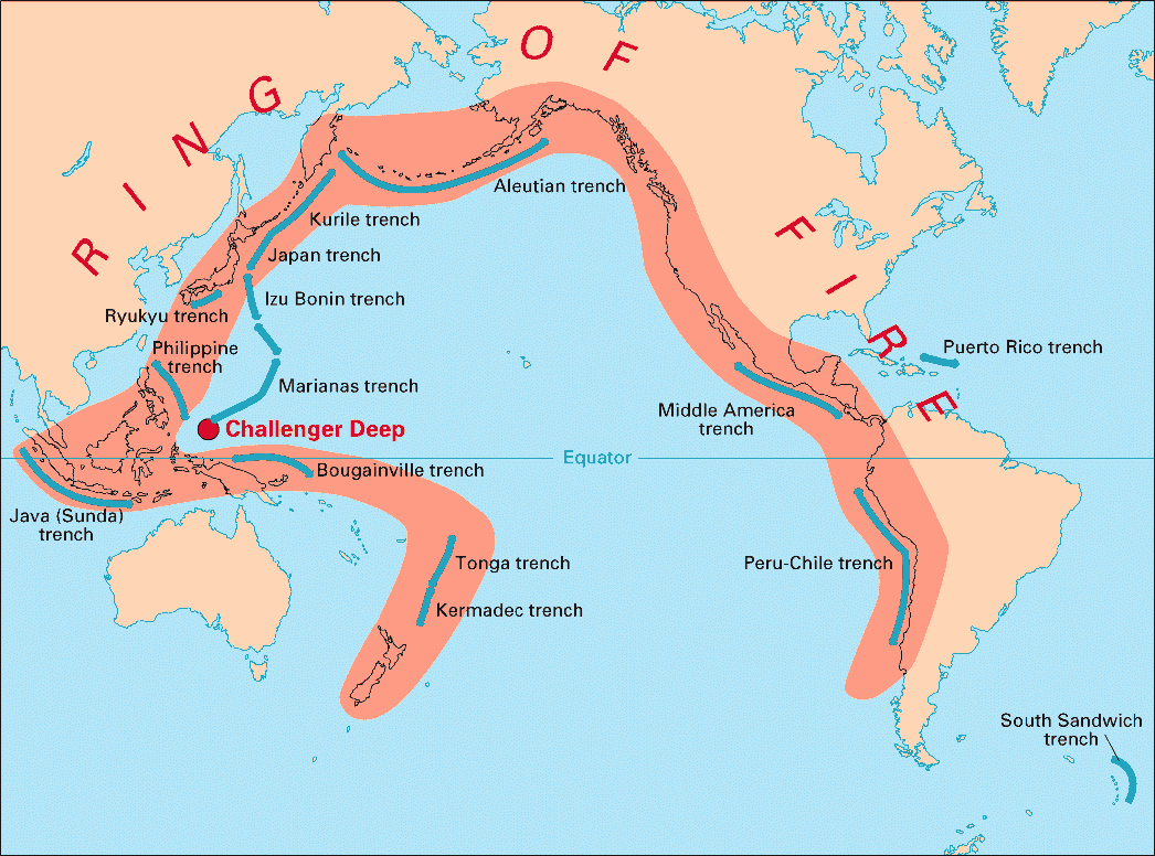
An image of the Ring of Fire
The formation of the Ring of Fire is the result of tectonic processes—specifically, the subduction of the Pacific tectonic plate beneath adjacent plates. This process causes the accumulation of energy, pressure, and heat, making it the world’s most concentrated epicenter for earthquakes and volcanic eruptions.
Among the approximately 450 volcanoes located along the Ring of Fire, they can be categorized as follows:
- Active Volcanoes : There are approximately 300 to 350 active volcanoes, making up more than two-thirds of the total count. These volcanoes have experienced eruptions over the past several millennia or continue to exhibit geological precursors suggesting potential future eruptions, prominent examples being Mount Fuji in Japan, Mount Merapi in Indonesia, and Mount St. Helens in the United States.
- Extinct and Dormant Volcanoes : Extinct and dormant volcanoes number around 100 to 150. Most of these are dormant volcanoes that have not erupted for hundreds or thousands of years, but are not yet considered completely extinct. Meanwhile, truly extinct volcanoes that have been cut off from their underground magma sources make up only a small minority.
Note : This proportion may vary slightly depending on the geologist’s definition, some of which include unexplored underwater volcanoes.
-
Krakatoa (Indonesia): Continuous volcanic ash plumes reaching 5,000 feet (1,500 meters) are impacting air traffic in East Sumatra, West Java, and Jakarta. Satellite imagery indicates lava flows on the south side of the volcano.
-
Etna (Italy): Ejected ash to a height of 16,000 feet (4,900 meters) and is moving eastward.
-
Fuego (Guatemala): Ejected ash to a height of 14,000 feet (4,300 meters).
-
Levotolo (Indonesia): Ejected ash to a height of 8,000 feet (2,400 meters) and moving northwest.
-
Ibu (Indonesia): Ejected ash to a height of 7,000 feet (2,100 meters).
-
Kono (Indonesia): Ejected ash to a height of 7,000 feet (2,100 meters).
-
Semeru (Indonesia): An ash plume eruption was observed moving southeast.
-
Canlaon (Philippines): An eruption has been reported, but no clear ash plume has been seen in satellite imagery.
-
Santiagito (Guatemala), Purace (Colombia), and Reventador (Ecuador): Periodic ash emissions were observed, but satellite imagery made them difficult to see due to cloud cover.
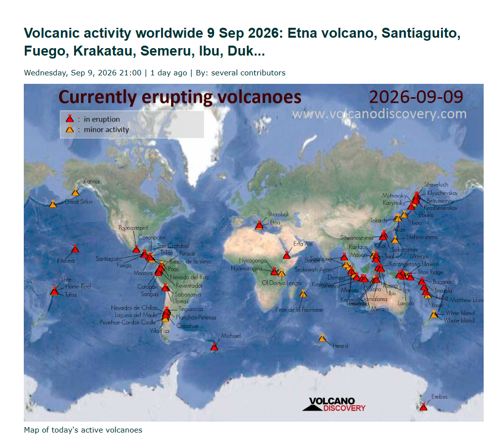
A status report from the Volcano Discovery website.
What is the actual truth?
After a Threads user named ‘@apiq_m’ posted a map claiming six Indonesian volcanoes started showing signs of erupting on September 1, 2026, causing widespread online anxiety: ‘The truth is, this claim is misleading.’ It takes completely normal natural events and blows them out of proportion to look terrifying, as outlined below:
- Simultaneous eruptions of six volcanoes are entirely normal: Prof. Dr. Santi Pailoplee, a lecturer in the Department of Geology at the Faculty of Science, Chulalongkorn University, explained that there are up to 452 volcanoes located along the Ring of Fire. Having two to six volcanoes erupting concurrently in the same month is completely normal as the Earth vents its internal heat.
- Past records show up to 56 simultaneous eruptions: Historically (such as in August and November 2021), as many as 56 volcanoes have erupted concurrently worldwide. Therefore, having only six eruptions right now is actually lower than the average.
- Distorted and exaggerated map illustrations: The map used in the post presents exaggerated data, such as showing signs of an eruption in the Nicobar Islands area, even though inspections revealed no volcanic activity whatsoever in that region.
Verification Process
- Expert Geological Interview: Prof. Dr. Santi Pailoplee from Chulalongkorn University’s Department of Geology explains that having a few volcanoes erupting at the same time is completely normal. He compares it to ‘people in the same condo all taking a morning shower at the same hour,’ stressing that it’s definitely not a sign of the end of the world.
- Global Geological Framework Review (USGS Verification): Inquiries into data from the United States Geological Survey (USGS) indicate that the Ring of Fire hosts roughly 300 to 350 active volcanoes that inherently possess the potential for eruption at any moment.
- Satellite and Real-Time Tracking Verification: Data from the Volcano Discovery website on September 9, 2026, revealed that volcanoes such as Krakatau (Indonesia), Etna (Italy), and Fuego (Guatemala) were emitting ash as part of their natural cycles—maintaining normal monitoring levels with no indication of a severe anomaly.
The Impact of This Misinformation
- Causing Public Panic: Fostering unfounded fear and anxiety among the public regarding non-existent natural disasters.
- Eroding Trust in Warnings: The recurrent dissemination of fabricated catastrophe reports induces public desensitization, raising the risk that individuals may dismiss legitimate crisis warnings issued in the future.
What to do with this misinformation?
- Think Before You Share: If you encounter disaster warning news that uses fear-mongering language, remain calm and stop forwarding it.
- Check with Trusted Sources: Always double-check the facts with official government agencies or academic institutions—like the Meteorological Department, the Department of Mineral Resources, the USGS, or reliable fact-checking organizations.
- Report the Post: Alert the social media platform so they can lower its reach and stop fake news from spreading to more people.

Popular Content